Updated 12.26.25
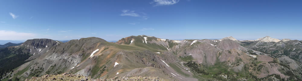
Utah’s highest drive-up launch at a whopping 11,700 ft! Stunning panoramas of the Tushar Mountain range await you on a flight from Edna.
Due to the the logistics involved getting to launch (long drive, dirt road, locked gate, etc,) local pilots have not been making the trek to Mt. Edna to fly often. However, that’s not to say that some pilots’ personal bests and most memorable flights begin at Mt. Edna. All typical high mountain desert flying rules apply here. Such information can be found here.
Mt Edna is primarily a morning site. Due to the east facing slopes at high altitude, thermals tend to begin very early here and have the possibility of becoming very turbulent early in the day. It is best to arrive at launch very early in the day to avoid the launch getting “blown out.” Plan to launch and fly at appropriate times according to pilot ability.
Special care should be taken to ensure one has the glide to reach a safe LZ in the valley. As the day progresses, the Tushar mountains typically produce a local valley breezes in the canyons leading up to launch that can be hazardous to the unaware. This valley breeze may make it impossible to glide out if one finds themselves low. Be aware that landing anywhere in the canyons is hazardous. “If in doubt, head out!” are wise words to fly by.
Also note that the Tushar Mountains are typically the first area to overdevelop on unstable days, and caution should be taken to land before such overdevelopment occurs. If clouds are rapidly growing taller than they are wide or if virga is present, pilots are strongly cautioned not to launch as gust fronts, lightning, and hail are likely to follow in quick succession.
Quick Info
- General Site Guidelines HERE
- High altitude Launch at 11,700 ft
- Access Requires a Key from a Local Pilot
- Multiple Launch Directions: See Individual Launches Below
- Recommended Wind Speeds: See Individual Launches Below
- P3/H3 or supervision Required
- Miniwings not Recommended
- 5.5 Minimum Glide Ratio Required
- Membership in USHPA and CUASA. CUASA membership form HERE
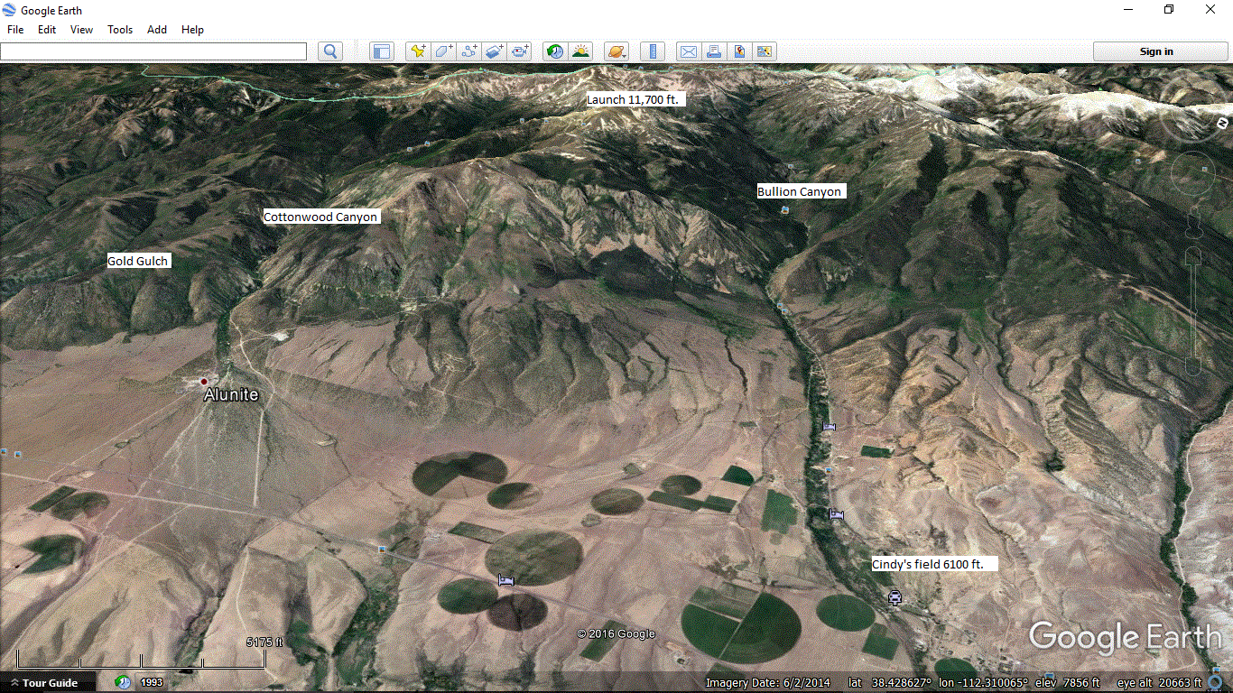
Launch
Located in a high alpine meadow near the Mid-Utah radio towers, multiple launch directions are possible. All launches are high mountain launches that deserve the respect and cation associated with such. Beware that even in the early morning, thermals can be amazingly strong. High altitude general flying information can be found HERE. Care should be taken to clear lines before launching as shrubs may entangle them.
Mt. Edna is primarily a morning site. It is advised to not launch later than noon as thermic activity typically sets up a strong valley wind and creates a danger of not having the glide to reach a safe LZ.
If launching from the SW, please note the ridge extending to the East that must be cleared to make it to the valley. Pilots have launched, lost the clearance and had to “top land” on the ridge which is not very friendly for doing so.
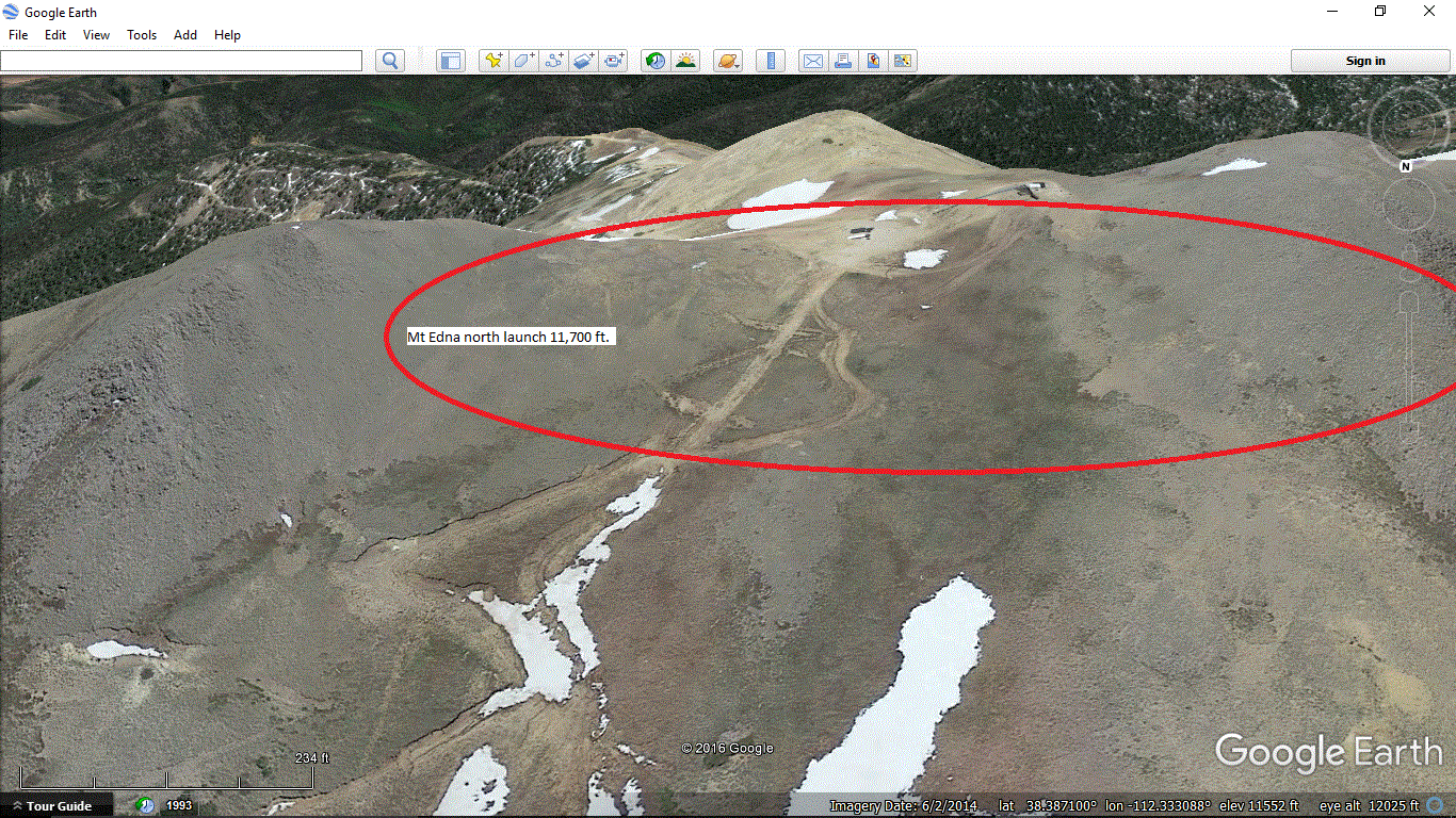
North Launch Use Parameters
- H3, Min 6, Ideal 12, Max 15, gusts to 5
- P3, Min 0, Ideal 6, Max 12, gusts to 5
- Direction: Ideal 315-45, OK 300-60
- glide Ratio 6.0
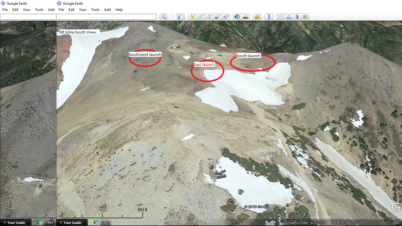
Southwest Launch Use Parameters
- H3, Min 6, Ideal 12, Max 15, gusts to 5
- P3, Min 0, Ideal 6, Max 12, gusts to 5
- Direction: Ideal 210-240, OK 190-270
- Glide Ratio 5.5
East Launch Use Parameters
- H3, Min 6, Ideal 12, Max 15, gusts to 5
- P3, Min 0, Ideal 6, Max 12, gusts to 5
- Direction: Ideal 70-110, OK 50-130
- Glide Ratio 5.5
South Launch Use Parameters
- H3, Min 5, Ideal 12, Max 15, gusts to 5
- P3, Min 0, Ideal 6, Max 12, gusts to 5
- Direction: Ideal 160-200, OK 130-220
- Glide Ratio 5.5
Launch is high-clearance 2wd accessible in dry conditions. A gate guards access to the last two miles of the road to launch. Contact a CUASA officer before going, and it may be possible to get a key to the gate. Otherwise, parking at the gate and hiking is an option.
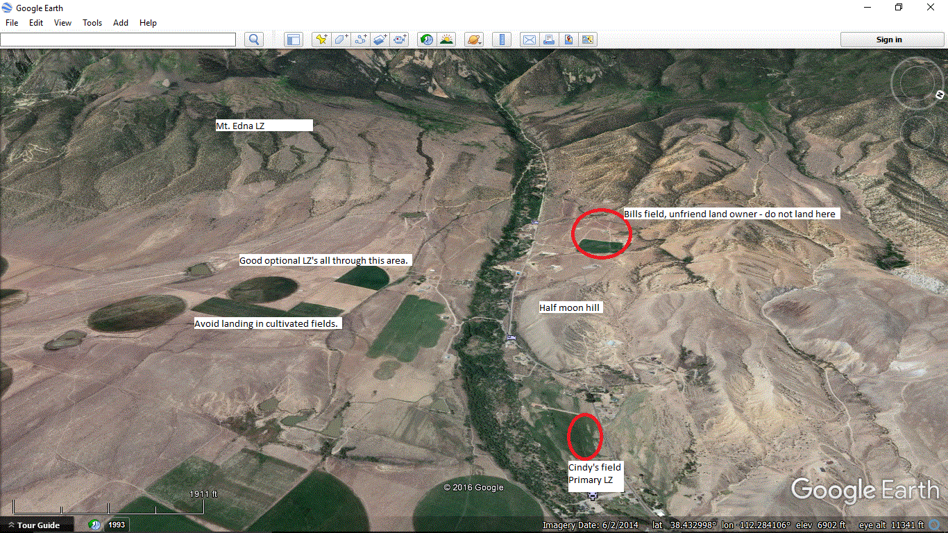
Landing Zone
Coordinates:
38°23’08.7″N 112°19’56.1″W
38.385754, -112.33224
Walking the LZ is recommended before flying.
If you find yourself without the glide to make the main LZ, don’t despair! There are many open areas to land in on the way to the official LZ, but please take care not to land in any cultivated fields. We would like to keep the local farmers happy by not destroying their crops.